


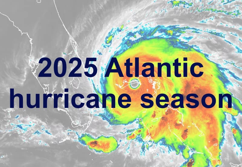
With just over one week until the official start of the on June 1st, US weather agency NOAA has issued its first forecast, giving a 60% chance of above normal activity levels, with between 6 and 10 hurricanes predicted over the coming months.Forecasters at NOAA’s National Weather Service forecast above normal levels of activity in the Atlantic basin this year, with above-average Atlantic ocean temperatures said to be setting the stage.The NOAA outlook gives a 30% chance of a near-normal season, a 60% chance of an above-normal season, and a 10% chance of a below-normal season.In storm and hurricane terms, that means a prediction for 13 to 19 total named storms, with 6 to 10 forecast to become hurricanes and 3 to 5 of those forecast to become major hurricanes during the season. NOAA’s experts say they have a 70% confidence in those ranges.
“NOAA and the National Weather Service are using the most advanced weather models and cutting-edge hurricane tracking systems to provide Americans with real-time storm forecasts and warnings,” explained Commerce Secretary Howard Lutnick.“With these models and forecasting tools, we have never been more prepared for hurricane season.” “As we witnessed last year with significant inland flooding from hurricanes Helene and Debby, the impacts of hurricanes can reach far beyond coastal communities,” added Acting NOAA Administrator Laura Grimm.“NOAA is critical for the delivery of early and accurate forecasts and warnings, and provides the scientific expertise needed to save lives and property.” NOAA says that a “confluence of factors” give rise to its prediction that the Atlantic hurricane season will see above-normal activity in 2025.
These include, “continued ENSO-neutral conditions, warmer than average ocean temperatures, forecasts for weak wind shear, and the potential for higher activity from the West African Monsoon, a primary starting point for Atlantic hurricanes.All of these elements tend to favor tropical storm formation,” NOAA’s announcement explains.NOAA added that, “The high activity era continues in the Atlantic Basin, featuring high-heat content in the ocean and reduced trade winds.
The higher-heat content provides more energy to fuel storm development, while weaker winds allow the storms to develop without disruption.“This hurricane season also features the potential for a northward shift of the West African monsoon, producing tropical waves that seed some of the strongest and most long-lived Atlantic storms.” It’s interesting that NOAA has highlighted warm ocean temperatures as a key driver for its above-normal forecast, as many meteorologists (including a number from within the insurance and reinsurance industry) have been pointing out in recent weeks that the main development region of the Atlantic basin is far cooler than seen at this time of year in recent years.When including all of the other we’ve seen so far, the average across them still calls for 16 named storms, 8 hurricanes and 3 major hurricanes.
This is slightly below the recent 10-year historical average for the Atlantic basin, but above each of the 30-year norm, median and long-term averages.As ever, it’s always important to point out that the number of storms that form, or that become hurricanes or major hurricanes, is not what matters to interests in the catastrophe bond, insurance-linked securities (ILS), or reinsurance markets.It is the direction of travel of storms, proximity to land and of course landfalls that matter.
With these mattering most in regions of high property density, urbanisation and so exposure or value concentration at risk.As hurricane season begins on June 1st, the industry will continuously keep one eye on the Atlantic tropics for any developing areas of investigation, depressions or storms.at this time has some exposure to US named storms and hurricanes, while for the broader property catastrophe reinsurance and retrocession market a similarly high percentage of reinsurer and ILS capacity is also exposed to Atlantic storms.
Which explains why the hurricane season is always a key point in the year when all eyes are often turned to the tropics.But beyond the risk to industry capital, the risk to lives and livelihoods is always front of mind as well.It’s worth adding that alongside its forecast NOAA also announced some initiatives that are positive and could contribute to the ability of the re/insurance and ILS markets to manage risk over-time.
NOAA’s model, the Hurricane Analysis and Forecast System, will be upgraded which it expects could drive another 5% improvement in the tracking and intensity forecasts it delivers.In addition, tropical cyclone advisory products will be able to be issued up to 72 hours before the arrival of storm surge or tropical-storm-force winds on land, and NOAA’s Climate Prediction Center’s Global Tropical Hazards Outlook has been extended from two weeks to three weeks, both of which will enhance warning insights and information for preparedness for communities and industries.Track the on our dedicated page and we’ll update you as new information emerges..
All of our Artemis Live insurance-linked securities (ILS), catastrophe bonds and reinsurance can be accessed online.Our can be subscribed to using the typical podcast services providers, including Apple, Google, Spotify and more.
Disclaimer: This story is auto-aggregated by a computer program and has not been created or edited by Health Insurance USA.
Publisher: Artemis
Publisher: Artemis