


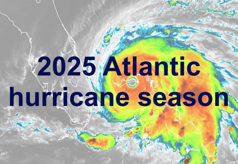
The Colorado State University (CSU) tropical meteorology team has maintained its forecast for the to see above-average levels of activity, citing low odds of El Niño occurring during the peak season and keeping its forecast numbers relatively aligned with the recent 10-year average.The Colorado State University (CSU) forecasters continue to call for 17 named tropical storms to form during the 2025 hurricane season in the Atlantic, with up to 9 of these becoming hurricanes and as many as 4 reaching major hurricane strength at Category 3 or higher.The group also maintains its forecast for the Accumulated Cyclone Energy (ACE) index, saying the most likely figure is 155 for this hurricane season.The CSU forecast team which while coming with the same storm totals tends to come with lower confidence than this early June update that was issued last week.
One thing that has changed in the forecast this month is the fact confidence in a developing El Niño seems to be waning somewhat.The CSU team “cites above-average subtropical eastern Atlantic Ocean and Caribbean Sea surface temperatures as a primary factor for their prediction of nine total hurricanes this year,” and conditions that are “anticipated to lead to a continuation of above-average water temperatures across most of the tropical Atlantic for the peak of the 2025 hurricane season.” They also explain, “The tropical Pacific is currently characterized by El Niño-Southern Oscillation (ENSO) neutral conditions.There remains some uncertainty as to what the phase of ENSO will be during the peak of the Atlantic hurricane season from August to October.
However, the odds of El Niño are quite low (13% per the latest NOAA outlook).El Niño – a recurring climate pattern – tends to increase upper-level westerly winds across the Caribbean into the tropical Atlantic.These increased upper-level winds result in increased vertical wind shear, reducing the odds of Atlantic hurricane formation.
The absence of these unfavorable conditions, as anticipated this year, is generally associated with upper-level wind conditions that are conducive for hurricane development across the tropical Atlantic.” However, they also note that in 2025 there is lower confidence in the June forecast for the hurricane season than is typical, “given that the primary climate signals (e.g., Atlantic and Pacific sea surface temperature anomalies) are somewhat weaker than they were last year at this time,” explaining that, “While the odds of El Niño this hurricane season are low, they are still considerably higher than they were for last year’s hurricane season.” The CSU team also notes that among its analog years selected for its forecast determination, there are years with higher levels of activity.“Our analog seasons had anywhere from above-average to hyperactive Atlantic hurricane activity,” explained Phil Klotzbach, senior research scientist and author of the forecast report.“While the average of our analog seasons had above-average levels of activity, the relatively large spread in observed activity in our analog years highlights the uncertainty associated with this outlook.” Overall, the CSU team forecasts a season with 125% of the activity of the average from 1991–2020, noting that last year’s season saw 130%.
While this is above-average for the 20 year and longer histories, it is quite closely aligned with the average Atlantic basin tropical storm activity of the more recent 10-year history.CSU’s landfall probabilities have not changed since its April forecast either.Meaning they continue to give a 51% probability that a major Category 3 or greater hurricane makes landfall in the United States, a 26% probability for a major Category 3 or greater hurricane making landfall on the east coast of the United States including Florida, and a 33% probability for a major Category 3 or greater hurricane making landfall on the Gulf Coast, all of which are above the long-term averages.
The probability of a major hurricane tracking through the Caribbean during the 2025 tropical storm season is also maintained at 56%, again higher than the long-term average.For Florida alone, there is a 65% chance of a hurricane and 35% chance of a major hurricane tracking within 50 miles of the coast of the state, according to the latest CSU probabilities, with both figures again above average.As always, it’s important to remember that the number of storms that form, or that become hurricanes or major hurricanes, is not what really matters to interests in the catastrophe bond, insurance-linked securities (ILS), or reinsurance markets, while seasonal forecasts still lack some skill when you look back at their verification, in many cases.
More storms means a greater chance of impacts, so above-average forecasts are always directionally important to be aware of.But, it is the direction of travel of storms, their proximity to land and location of actual landfalls that matter.Any hurricane landfall in a region of high property density, urbanisation and so insured exposure or value concentration at-risk, are what really matter, both for the industry and the communities that might be affected by this year’s hurricane season.
Track the on our dedicated page and we’ll update you as new information emerges..All of our Artemis Live insurance-linked securities (ILS), catastrophe bonds and reinsurance can be accessed online.Our can be subscribed to using the typical podcast services providers, including Apple, Google, Spotify and more.
Disclaimer: This story is auto-aggregated by a computer program and has not been created or edited by Health Insurance USA.
Publisher: Artemis
Publisher: Artemis